
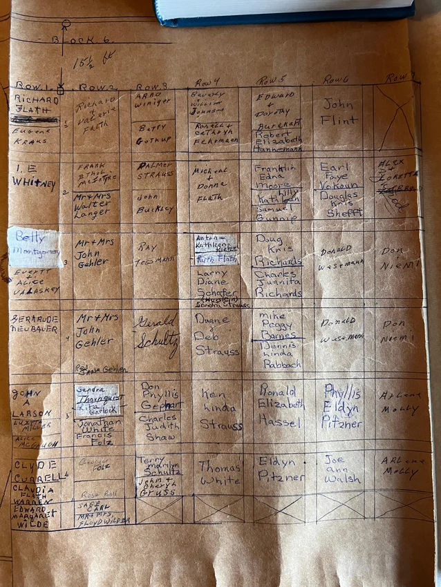
Aging paper maps. Spreadsheets with missing cells and endless rows.
What used to be essential cemetery management tools are now creating customer service bottlenecks for some cemeteries. Why? For cemeterians, information everywhere is information overload. When maps and records are scattered across multiple sources, it’s difficult to help grieving families quickly and effectively.
What happens when paper maps are damaged and there’s no backup? How do you deal with conflicting logbook entries? Contradictions between sources creates uncertainty, making it hard for cemetery staff to tell which plots have been sold and which ones are available.
That’s where cemetery mapping software comes in. Cemetery mapping software gives cemetery staff all the information they need, all in one place. It connects records to interactive cemetery maps, giving cemeterians real-time insights into available and booked plots.
In this post, we outline the fundamentals of cemetery mapping software: what it is, how it works, and what benefits it provides for your cemetery.
What is cemetery mapping?
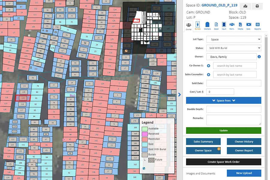
Cemetery mapping is the process of managing a cemetery’s land and data on a visual drawing or picture. Cemetery maps may come in the form of paper records and logbooks, spreadsheets, databases, or interactive digital maps. Regardless of the format, the goal of the cemetery map is simple: to keep all information about a cemetery in one place.
Maintaining accurate cemetery maps is important for three reasons: up-to-date maps improve day-to-day operations, ensure your staff is selling available plots, and help local families navigate your cemetery. Accurate maps and records help cemetery staff better serve their communities. For this reason, cemetery mapping is an essential part of preserving and managing a cemetery.
What is cemetery mapping software?
Cemetery mapping software connects records and burial data to interactive digital maps of your cemetery. Instead of combing through paper records and logbooks, cemetery managers can view available and booked plots in real-time from any device with internet access. The most accurate cemetery mapping software solutions use GIS mapping to create highly accurate maps that capture the exact location of every burial on your cemetery grounds.
Many modern mapping programs also integrate with drone and aerial photography and include advanced features like access to public portals for viewing cemetery maps, walk-to-grave navigation, and financial management modules.
GIS mapping for cemeteries: how it works
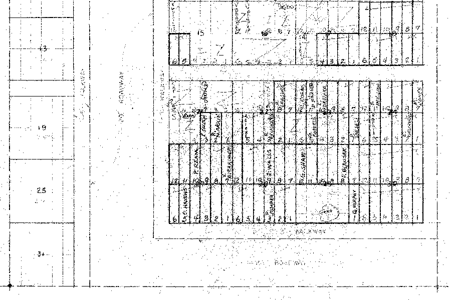
Cemetery mapping software digitizes cemetery sections, lots, and individual spaces. Inventory records, deeds, and ownership details are then applied to their corresponding space on the digital map. Cemetery software programs can transform paper maps and hand-drawn records or migrate maps from legacy software.
Not all cemetery mapping software provides the same level of detail or functionality. Software solutions like CIMS are powered by GIS smart maps. To create a GIS map of your cemetery, your provider will collect detailed information about your cemetery, including burial coordinates, satellite imagery, unique features like vegetation, roads and utilities, mausoleums, monuments, walls, and historical logbooks, maps, and records. When necessary, software partners may also provide ground-penetrating radar services to uncover hidden burials and locate available inventory for your cemetery. Your software provider will work with you and your staff to validate all the data you share.
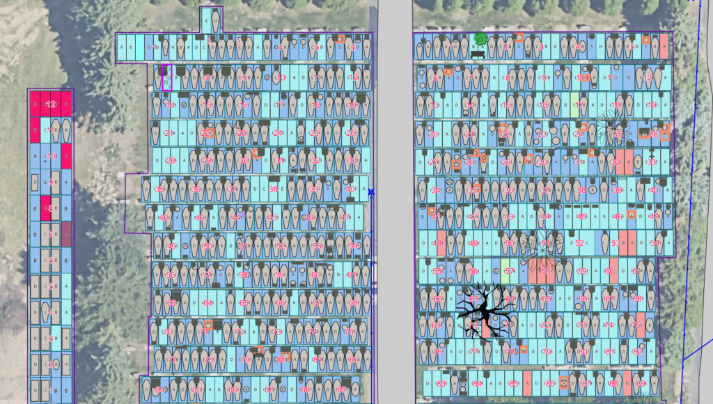
GIS cemetery maps layer all your cemetery information onto an interactive 3D map of your grounds. These maps go beyond grave locations: they create a true-to-life model of your cemetery. Burial shapes, custom markers, and real-time updates are all accounted for, meaning your cemetery map matches all the cemetery information you have today. This level of detail empowers staff to sell available inventory and provide records at a moment’s notice. You can also show families exactly what your layout, sections, and available plots look like without traveling to your grounds.
Implementing cemetery mapping software is more than downloading a new program to your computer. Software providers review and organize existing records, migrate and validate cemetery data, and create high-fidelity digital maps before onboarding cemetery staff into the program.
Benefits of cemetery mapping software
Cemetery mapping software connects all ownership, interment, and marker information on a secure digital map, making it easier to locate and update records. Here are the four biggest advantages of implementing mapping software at your cemetery.
Seamless record management
Cemetery mapping software uses images of your cemetery grounds as the base layer of your online map, meaning all burial information can be tied to the exact location of every burial in your cemetery. With all your burial data in one place, you can quickly navigate between cemetery sections and plot locations to find the information you need.
GIS cemetery maps allow you to see other important cemetery features, like monuments, utility lines, and vegetation. Plus, with color-coded cemetery maps, cemeterians can get an up-to-date picture of cemetery business with a simple glance. This level of detail helps avoid complications during cemetery expansions. A reliable map today limits risks related to disturbing existing burials when opening a new grave. With an accurate model, cemeteries can ensure that new plots are properly allocated and avoid unexpected obstacles.
Real-time insights into inventory
With mapping software, cemetery maps and records update in real time. This gives your sales team the latest insights into cemetery inventory and keeps everyone on the same page. Plus, cemetery staff can leverage the software to track sales activity and uncover new opportunities.
The accuracy and ongoing improvements to GIS maps means families can trust that their loved ones’ burial sites are accurately documented and maintained. Accurate maps show the cemetery’s commitment to care, preservation, and professionalism.
24/7 access
Modern cemetery mapping software platforms store data on the cloud, meaning you can access your cemetery maps and records from anywhere with an internet connection. Unlike paper maps, online cemetery maps are safe from the elements. Plus, you don’t need to be in the cemetery office to view them. You can show records from anywhere, and your team can access work orders from the field.
Data security and compliance
Many municipalities and state-run cemeteries must adhere to strict cemetery software security and compliance standards. Modern cemetery software tools offer a higher degree of security than on-premise record-keeping. Many software programs include control and role-based user permissions, multi-factor authentication and password policies, regular data backups and redundant storage, encryption at rest and in transit, and advanced hosting and compliance measures. These features protect cemetery managers from malicious actors and preserve records in the event of an outage.
Cemetery mapping features to look for
Buyers should look for GIS mapping technology, drone imagery integrations, and public access to digital cemetery maps when evaluating cemetery mapping software products.
GIS mapping
Geographic information system (GIS) is technology that is used to create, analyze, and map different types of data. GIS mapping attaches information from your database—such as interment records, contracts, deeds, and other documents—to a highly accurate map of your cemetery. Ask your software provider if they’re delivering GIS smart maps or using a lower-fidelity mapping solution.
Integration with drone and aerial photography
Drone photography provides high-resolution, spatially accurate orthophotos—the perfect foundation for a digital cemetery map. With drone photography, your cemetery map will look exactly like your cemetery, showing off your beautiful landscaping, highlighting unique features and vegetation, and placing graves where they actually are.
Public portal for cemetery maps
Public burial portals like Burial Search share your digital maps and records with your community. By using public grave finding portals, members of the public can access and navigate your cemetery’s information via the web, a smartphone, or an on-site kiosk.
Tree and vegetation management
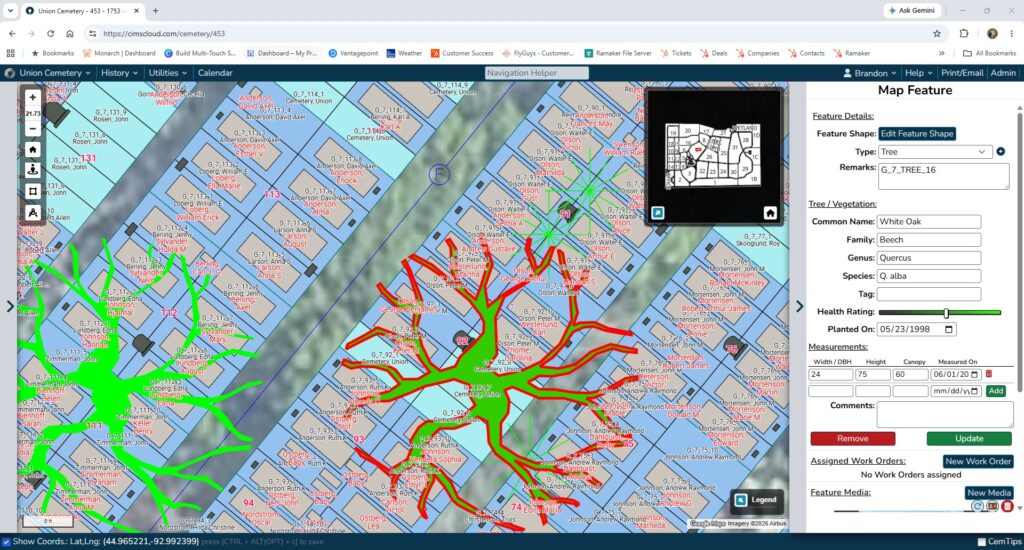
Cemetery maps track more than burials and available plots. Cemeteries have many unique features, including spaces occupied by roots and other vegetation. Cemetery mapping software should track everything on your grounds (even your trees).
How long does the cemetery mapping process take? A step-by-step breakdown of implementation
Your cemetery software implementation timeline may range from one month to several months depending on the state of your records, the size and complexity of your cemetery, and how involved you are in the migration process. Transitioning to GIS maps consists of four phases: data transfer, verification, setup for your cemetery, and training for your staff.
Phase 1: Records transfer and audit
Record transfer involves sending available records, including plot maps, deeds, ownership documents, interment records, and available inventory, to your cemetery software partner. This step is the most important part of onboarding management software. Your records create the foundation of your interactive map and determine its accuracy. To expedite the implementation process, make sure your data is accessible, clean, and organized when you sign your software contract. If your cemetery uses old paper records, legacy software, or competing spreadsheets, record audits may take additional time to ensure accuracy.
Phase 2: On premise verification and additional data capture
Depending on the completeness of your maps and the complexity of your cemetery, it may be necessary for your software engineering team to conduct site work on your grounds. Your provider will collect geographic information, map unique features, and work with grounds staff and municipal agencies to map utilities. If you need to locate unmarked graves or inspect a new section, your software partner can also scan the grounds with ground-penetrating radar. This additional data capture isn’t necessary for every cemetery. Ask your partner if they recommend a site visit during the implementation process.
Phase 3: Setup and validation
GIS mapping software isn’t plug and play. It’s custom for your cemetery. After your software partner collects all necessary data, they begin building your cemetery map, linking historical records and documents to grave spaces.
Phase 4: Staff training and implementation
Software only saves your staff time and energy if they know how to use it. After your map is ready, your software vendor should provide detailed cemetery software training and onboarding for your staff. Training should cover basic navigation, how to complete daily tasks, features that improve efficiency, and how to conduct real-world workflows like updating burial records, processing sales, generating reports, and managing work orders.
Cemetery mapping software FAQs
Cemetery database software stores cemetery records, documents, and interment information but may not have a mapping element. Cemetery mapping software refers to solutions that include a GIS or user-generated mapping layer. The software then links records from the database to their corresponding burial location.
Modern cloud-based mapping programs provide significantly stronger cemetery software security than on-premise cemetery applications. Cloud-based programs store sensitive data in professionally managed data warehouses. These centers are designed to protect your data. Facilities have multiple layers of physical security and provide real-time security patches to keep your records safe from bad actors. Centers also offer active maintenance, continuous monitoring, and data encryption and adhere to rigorous compliance standards.
Yes. Cemetery mapping software providers often migrate paper maps and records into modern, cloud-based solutions. The quality and completeness of your existing maps will affect the migration timeline. Cemeteries with partial or outdated maps may require additional on-premise data collection to make sure your digital maps reflect the current state of your grounds.
To fill in gaps in your cemetery maps and records, start with what you know. Gather all available deeds, records, and cemetery documents to generate a broad sketch of the cemetery layout. Historical societies, genealogy groups, libraries, and other local organizations may be able to provide additional information about your plots and grounds.
After you consider all available resources, identify the areas where more detailed mapping is needed. Services like ground-penetrating radar can provide clear insights into burial locations, utility lines, and other underground features at your cemetery. Aerial photographs and drone imaging can provide an accurate and up-to-date view of your grounds today. Together, these modern technologies can help cemetery managers address incomplete records and improve their maps.
That being said, the best way to preserve your records and prevent information gaps in the future is to digitize your maps, records, and documents using cemetery software with GIS mapping capabilities.
Yes. Software vendors help cemeteries with data migration from Excel spreadsheets and other local databases. While spreadsheets can help capture, organize, and filter cemetery data, GIS maps give those records context. GIS maps connect records to exact physical locations, allowing cemetery staff to explore associated documents with specific burials and see available inventory in real time.
See CIMS cemetery mapping software in action
Interested in creating digital smart maps for your cemetery? Schedule a product demo with a CIMS expert to see mapping software in action.