Confirm burials. Build better maps.
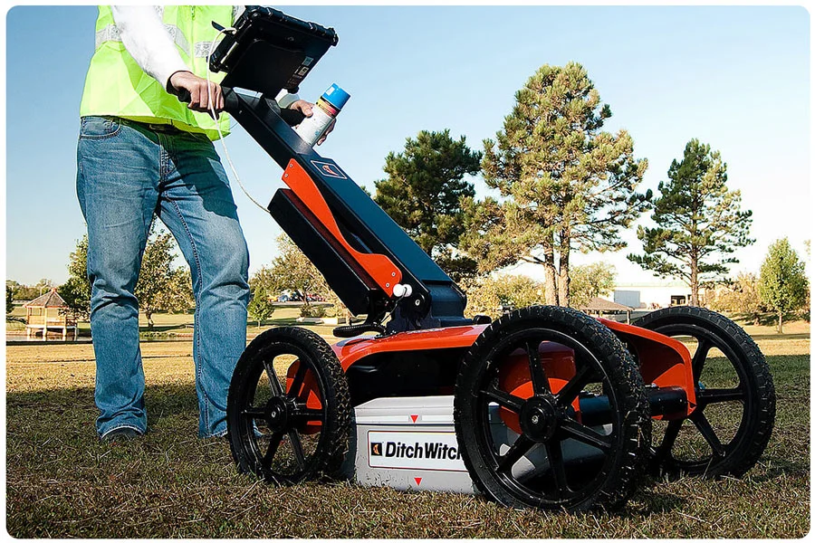
Ground penetrating radar (GPR) helps cemeteries analyze their grounds without disturbing the soil. A transmitted wave reflects objects found in varying degrees of the soil, and reflected signals are mapped into an image. This image can then be used to analyze materials found in the subsurface and confirm burial locations.
- Confirm burial locations
- Locate burials in new sections
- Scan for hidden objects
- Find water lines and other utilities
- Improve your cemetery maps
I want to learn more!
Get GPR pricing for your cemetery
Questions About CIMS?
We’re here to help you understand how CIMS can support your cemetery and the families you serve.
CIMS is a comprehensive cemetery management software designed to help cemeteries digitize records, manage grave ownership and burials, maintain accurate maps, and improve day-to-day operations.
CIMS is used by municipal, faith-based, private, and association-managed cemeteries of all sizes across the United States and Canada.
Easy-to-use inventory management features, accurate GIS mapping, multi-user capabilities, and web-based access from any device should be treated as must-haves when selecting cemetery software. Cemeteries should also consider:
Public record search capabilities, such as Burial Search.
Integration with drone imagery for mapping fidelity.
Financial tools like CIMS Ledger.
Cemetery software is an investment. 1,200+ cemeteries have invested in CIMS because our tools give your staff more time for the personal touches that matter most.
CIMS helps cemeteries move existing records, whether in analog or digital formats, into their new CIMS database. From data conversion to record entry and maintenance, the CIMS team provides a variety of data migration services to get cemeteries up and running.
Our team has helped cemeteries migrate paper records and transferred data from other tools like Microsoft Access, Microsoft Excel, Microsoft Word, Microsoft Works, CSV, DBF, and FileMaker Pro files, as well as DOS databases, and Microsoft SQL servers.
Yes. CIMS is a cloud-based platform that allows authorized users to securely access cemetery records and maps from anywhere with an internet connection.
Yes. Authorized users can concurrently access CIMS securely from multiple computers or locations.
Ready to put families first?
See how CIMS can help your team spend less time on administrative work and more time doing what truly matters—supporting families and honoring lives.