
Cemetery Mapping from GPS to GIS
Even with several decades of records digitization, technology is still being introduced in many cemeteries across North America. Cemetery management software has enabled managers to maintain burial records, manage inventory, and provide transparent access for visitors and genealogists. But a key component is accurately mapping the cemetery. At CIMS, our industry-leading mapping capabilities allow us to get the most accurate assessment of the site to be integrated with our software platform.
Why is Mapping Important?
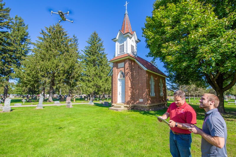
One of the first steps in digitizing cemetery records includes mapping the property. When a cemetery is transitioning from an older database or even paper records and maps, we need to verify the existing conditions and burials. Technologies like GPS and GIS help us implement a host of tools to map a property. Some of those tools include drone photography, ground-penetrating radar, and GPS surveying.
What is GPS for Cemeteries?
GPS stands for Global Positioning System. It is a surveying and navigational system tied to signals from an array of satellites. It is used for everything from airplane navigation to spatial mapping and directions. For cemeteries, we are able to placemark and record locations on the ground with extreme accuracy including burial plots and trees and vegetation. So GPS is really the way we record the data that we then transfer into our software for actual mapping.
Mapping headstones and vegetation with GPS can be as easy, but for unmarked or unknown spaces, we often utilize a ground-penetrating radar for in-depth mapping. We can identify underground shapes which can aid in orientation and better plot boundary definitions.
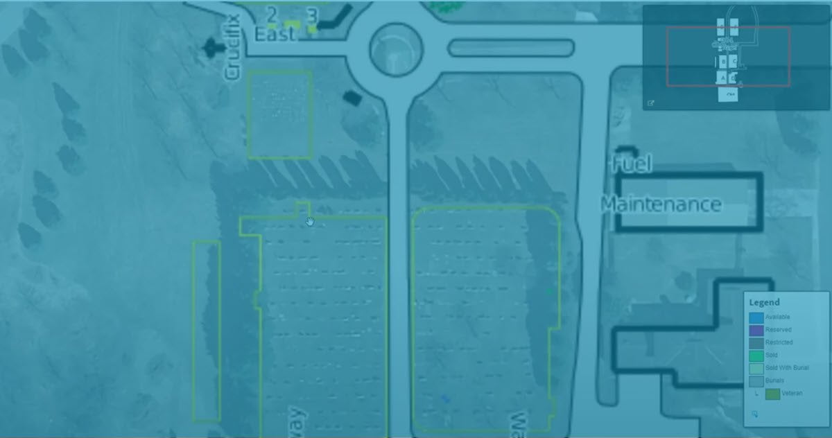
GIS Mapping for Cemeteries
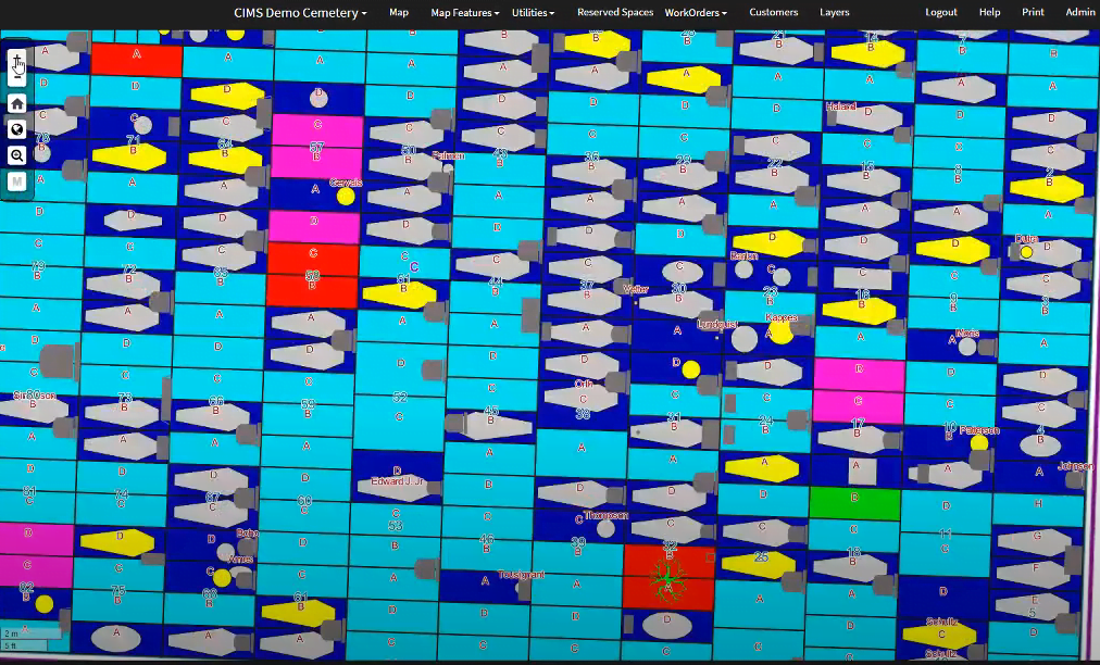
Geographic Information System or GIS is a framework for managing and analyzing data that can then be translated into maps or even 3D scenes. In cemeteries, we are able to take the GPS data and convert it into an online platform using GIS. It effectively becomes the root database for our management software called CIMS, but it can also be the basis for an online burial finder like www.burialsearch.com.
Visitors can also access our GIS software for help locating a loved one in a cemetery using their phone with accuracy down to the foot.
CIMS Software Capabilities
CIMS was created to help administrators and managers of municipal, private, and religious cemeteries. We offer desktop and cloud-based software solutions and a suite of integrations including Quickbooks and Salesforce CRM. Take a look at our full list of features.
Interested in a Demo?
Contact our team at CIMS to see if our solution might be the right for you.
About CIMS
Our background in engineering and infrastructure design and developments enabled our technology services team develop a software solution specific to cemeteries. Over the past 20 years, we’ve helped over 1,000 cemeteries in 49 states computerize their records and build GIS maps using our software, CIMS. As part of Ramaker, we have a deep background in helping municipalities, school districts, and private businesses implement GIS for community development, utility layouts, and emergency management planning.

